

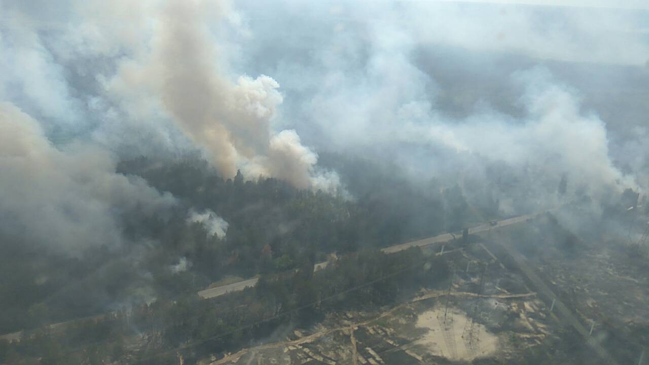
Almost every catastrophic wildfire begins as something small: a spark in dry grass, a lightning strike in remote forest, a fire that, for its first hour, a single crew could have contained. The disaster is usually a detection failure before it is a firefighting failure. Fires in empty country can burn for hours before anyone sees the smoke, by which time wind and heat have made them unstoppable. A new generation of early-warning satellites aims to close that gap, scanning fire-prone regions continuously and alerting responders within minutes of ignition, and fire agencies are beginning to reorganise around the speed they offer.
The physics of the problem explains the technology. A fire radiates heat in infrared wavelengths long before it is big enough to see, and sensitive instruments in orbit can detect that signature against the cooler background of forest and soil. Weather satellites operated by agencies such as NOAA already provide fire data, and their alerts have saved property and lives. But general-purpose satellites revisit any given spot infrequently and see it coarsely. The new systems are built specifically for fire: constellations of smaller satellites that pass over the same ground far more often, with sensors tuned to catch small, hot sources early, a shift tracked in reporting at our environment coverage.
Why the First Hour Decides a Wildfire
Frequency is the crucial improvement. A satellite that revisits every few hours will eventually find a fire; one that effectively watches a region every few minutes can find it while it is still the size of a garden bonfire. Designers of the newest constellations talk about detection thresholds down to a few square metres under good conditions. Combined with weather data, the systems can also predict which ignitions matter most, flagging a small fire in high wind above a town more urgently than a larger one in a wet, empty valley, and so help controllers spend scarce crews where the risk is real.
Detection, however, is only the first link in a chain that has to hold under pressure. An alert must reach the right control room, be trusted quickly, and translate into aircraft and crews moving while the information is still fresh. Agencies testing the systems emphasise the unglamorous parts: agreed alert thresholds, integration with existing dispatch software, and training that prevents both complacency and alert fatigue. False alarms are inevitable, from industrial flares, hot rooftops and sun glinting off metal, and the software must learn each region’s normal heat signatures so that firefighters are not sent chasing ghosts across the landscape.
How the New Satellites See Fire From Orbit
The economics argue strongly for making the chain work. Wildfire suppression costs run into billions in severe years, and the losses to homes, infrastructure, health and ecosystems are far larger. Studies of past fires repeatedly find that rapid initial attack is the single best predictor of containment, which makes early detection among the cheapest interventions available.
There are limits that honesty requires naming. Satellites see heat, not causes, and they cannot see through the thick smoke of a fire already raging nearby. Climate change, meanwhile, is widening the target: longer fire seasons and more extremely dry days mean more ignitions in more places, including regions with little firefighting tradition. Detection buys time, but it does not reduce the fuel, the heat or the wind that decide what a fire becomes.
From Detection to Boots on the Ground
Even so, the change in capability is real, and firefighters describe it in practical terms: arriving at a fire measured in square metres rather than hectares, in daylight rather than after a night of growth, with a map of its heat in hand. Pilots and crew chiefs who have worked with satellite-guided dispatch say the first hour of a fire feels different when you know where it is. That difference, multiplied across thousands of ignitions each season, is where the technology earns its cost.
The constellations are still growing, and coverage will thicken over the next several years as more satellites launch and the data systems mature, developments followed in the News section. The ambition stated by their builders is striking: no fire on Earth burning unseen for more than a few minutes. Reaching it will not end the wildfire crisis, which is rooted in climate, land management and where people build. But it would remove its cruellest element, the head start, and give the people who fight fires a fairer contest.
